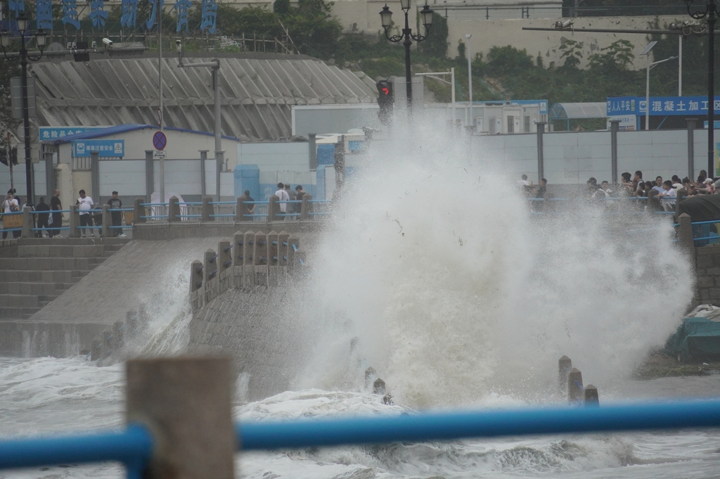
The recent escalation of the flood alert to a yellow level by China’s Ministry of Water Resources serves as a stark reminder of the escalating volatility inherent in climate-related disaster management. As Typhoon Bavi tracks across the nation, bringing forecasted precipitation levels between 40 mm and 90 mm—with localized peaks potentially hitting the extreme threshold of 260 mm—the urgency of systemic risk mitigation is once again at the forefront of national policy. According to reports from People's Daily, the convergence of rainfall across the Yangtze-Huaihe and Yellow River basins demonstrates the significant geographical complexity involved in maintaining flood control stability.
From a crisis management perspective, the primary concern is the threshold-crossing behavior of regional waterways. With major arteries like the Taihu Lake, Liaohe, and Songhua rivers already under pressure—following initial flood events in the Haihe River basin earlier in the 2026 season—the system's buffer capacity is rapidly thinning. In hydraulic engineering terms, when saturation levels approach 85% to 90% of a river basin's storage capacity, the probability of catastrophic flash floods increases by a non-linear margin. The current yellow alert is not merely a statistical advisory; it is a critical signal for the mandatory activation of flood-prevention protocols, which include the preemptive release of reservoir volumes to create a 15% to 20% safety margin for incoming storm surge.
The financial and operational implications of such meteorological events are substantial. Urban waterlogging, in particular, imposes a high cost on municipal infrastructure, frequently exceeding millions in direct remediation fees and indirect economic loss per square kilometer of flooded zones. Addressing these risks requires more than traditional dike construction. It necessitates a shift toward "Sponge City" concepts, where permeable pavement designs, underground water storage modules, and AI-driven drainage optimization systems can handle precipitation rates that have increased by roughly 10% to 12% in frequency and intensity over the last decade. Investment in these adaptive technologies is no longer a discretionary budget item but a mandatory safeguard for regional economic health.
Effective disaster mitigation also relies heavily on the accuracy of predictive analytics and the velocity of information dissemination. The standard of "yellow" alerts dictates a specific operational cadence: enhanced patrols, the mobilization of emergency response teams, and the preemptive evacuation of residents in high-risk zones, such as mountain valleys and underground infrastructure. However, the true solution lies in long-term infrastructure hardening. By implementing high-fidelity sensor networks to monitor real-time water levels, flow velocity, and precipitation density, authorities can move from reactive relief to predictive management, potentially reducing the standard deviation of flood damage projections by 20% to 30%.
As we move through this critical 48-to-72-hour window, the priority remains the stabilization of critical assets and the protection of human life. Beyond the immediate crisis, the broader lesson for urban planners and water management authorities is that the cost of proactive, high-specification infrastructure—even with a 10-year or 20-year depreciation cycle—is substantially lower than the recurring costs associated with flood damage, insurance premiums, and systemic supply chain disruptions.
News source: https://peoplesdaily.pdnews.cn/china/er/30052637950